Maps and Directions
Drax is a village in North Yorkshire, England, about 6 miles (10 km) south-east of Selby, best known today as the site of Drax power station.
Drax
Directions to Drax Social Club
FROM THE SOUTH and WEST
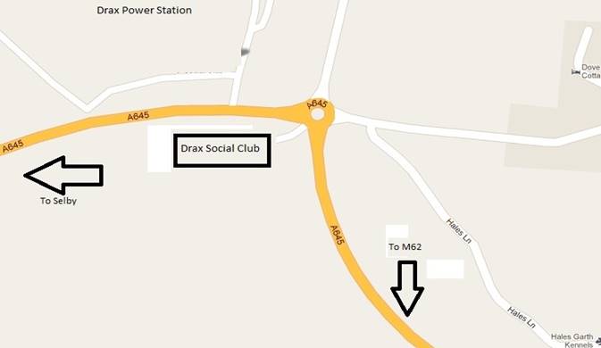
From the M62 leave at junction 36 and turn on to the A614 – signposted Rawcliffe, first left off the slip road roundabout. At the first road roundabout take the second exit on to the A645 - signposted Drax. At the next roundabout the entrance to the club is the first exit (not signposted but difficult to miss).
FROM THE NORTH
You have a choice of remaining on the A1 and turning east towards Hull when you reach the M62 and then following the directions above.
If you are relying on a SatNav it may well take you across the A64 east towards York and then south down the A19 towards Selby and around the bypass and onto the Bawtry road to Camblesforth where you should turn left to Drax.
FROM LINCOLNSHIRE and EAST ANGLIA
You have a choice of A1, M1, M18 or M180 to get you onto the M62 and then once more follow the instructions from junction 36. A SatNav may try to take you over the Humber Bridge as being slightly shorter in distance but it is only about 5 miles so it is NOT worth the toll!
The postcode YO8 8PJ appears to work satisfactorily with most SatNavs.
This map shows the immediate road layout at the club.
Venues
Drax Social Club
Main Rd, Drax, Selby YO8 8PJ
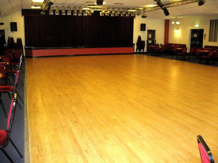
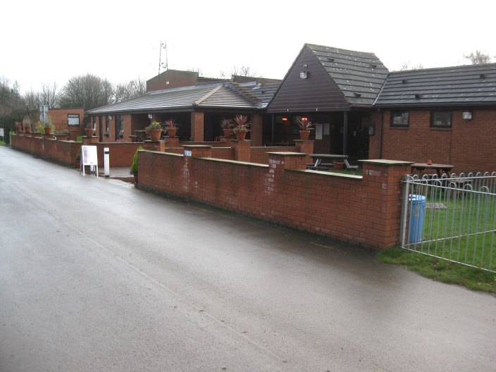
The Club Is situated between Goole and Selby and hosts a large number of diversified events the whole year through. It contains an excellent large hall ideal for dancing and a smaller room that could be used for music or small in numbers dance workshops It also has:
- Ease of access via the motorway system and public transport
- An excellent spacious level campsite with all facilities including water, showers, elsan emptying and 24 hours flush toilet access
- Excellent food at all reasonable times at sensible prices
- A bar with real ales, again at reasonable prices
- Lots of unrestricted parking
- Plenty of good quality accommodation within a short drive of the venue
- A semi rural position
- See www.draxsandsclub.co.uk for more details
Snaith School
Snaith School - Pontefract Rd, Snaith, Goole DN14 9LB - is a few minutes drive with excellent parking.
It is of a good size and ideal for dancing.
There is also a kitchen, which will be used for tea or coffee breaks between workshops.